Can you name the Country with the Clues we provide? Each day a video clue will be posted right here, and your guesses can be placed in the box by the large map on the way to the gym at Village School. Click on the photo and see the video for a brand new clue. Be sure to check back Monday through Thursday. The Mystery Country will be revealed on Fridays during morning announcements! Have fun learning about other countries and where they are on our map!

May 23 through May 27th Adventure

The Cathedral Ghent
We've left Finland traveling 1,030.7 miles southwest (1658.7 Kilometers / 895 Nautical Miles) to our new Western European Country destination that is approximately the size of Maryland.  
Despite its small size, it is the main trading partner of India along with the UK (partly because of the diamond and steel industries).

This country is known for its medieval old towns, Flemish Renaissance architecture and is the international headquarters of the European Union and NATO. 

The country is divided into 2 distinctive multilingual regions: Dutch-speaking Flanders to the north and French-speaking Wallonia to the south. The bilingual capital, Brussels, is home to ornate guildhalls at Grand-Place and an art nouveau-influenced European Quarter.
The Capital City
The Flag

Geographic coordinates: 50 50 N, 4 00 E
Capitals: City of Brussels
Population: 11.2 million (2013) World Bank
King: Philippe of Belgium
Government Type: Federal Parliamentary Democracy under Constitutional Monarchy 
Continent: Europe
Official languages: French, Dutch, German

Tax levels in this country are among the highest in the world, with about 40% of gross earnings given up in tax for a single-income family. A study for 2005 reveal that this country had the highest average income tax rate out of 30 OECD countries. Total taxation represents 45.6 % of the country's GDP. Inheritance tax can reach up to 80%. The Royal family alone receives 12 million € of tax-payers' money each year.

Environment - current issues:
the environment is exposed to intense pressures from human activities: urbanization, dense transportation network, industry, extensive animal breeding and crop cultivation; air and water pollution also have repercussions for its neighboring countries


Natural hazards: flooding is a threat along rivers and in areas of reclaimed coastal land, protected from the sea by concrete dikes

Agriculture - products:
sugar beets, fresh vegetables, fruits, grain, tobacco; beef, veal, pork, milk
The Arnolphini Wedding (1434)
One of three panels 
Oil 


Industries:
engineering and metal products, motor vehicle assembly, transportation equipment, scientific instruments, processed food and beverages, chemicals, base metals, textiles, glass, petroleum

This country's painters are credited to have invented oil painting in the 15th century (probably Jan van Eyck). 


The Education system


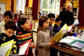
The language of education is Dutch in the Dutch region, French in the French region and German in the German region. In the Brussels-Capital Region, the languages of education are Dutch or French, as the parents choose. 
The language of education is Dutch. However, if the child’s mother tongue is French, and if the head of the family resides in one of these municipalities, the child may attend a French-language school.


Primary Education

There are 3 different kinds of schools in Belgium, namely community schools, subsidized public schools, and subsidized free schools which are normally affiliated to the Catholic Church. Private home education is permissible too, and these numbers are rising slowly. Education is mandatory between ages 6 and age 18. Following an almost universal period of voluntary pre-school, children enter primary school for a period of 6 years. There a curriculum based on reading, writing and basic mathematics encourages interest in a broader range of subjects too.

Secondary Education

Secondary schooling unfolds through 3 phases. The 1st one creates a solid general basis, while the 2nd and 3rd ones increase in specificity. Overlaid across these are 4 different genres of schools, namely general secondary schools, technical secondary schools, vocational secondary education schools, and art secondary education institutions. Over and above these, students with disabilities can follow special syllabi.

Vocational Education

In Flemish-speaking areas of this country, ongoing vocational education and training provides a good spread of opportunities for further and second-chance adult education. Policy is dynamic, and the system is accordingly under continuous reform.

Tertiary Education

Belgium EducationAnybody with a qualifying secondary school diploma may enroll at any one of several universities, although additional entrance examinations are generally required by faculties of civil engineering, architecture, medical and dental sciences, nautical sciences and fine arts. 


The oldest Flemish university is the University of Ghent illustrated here. It was founded by King William 1st of the Netherlands in 1817, and currently has a student body in excess of 30,000, plus approximately 7,100 staff in total employed in 11 faculties.

The Food

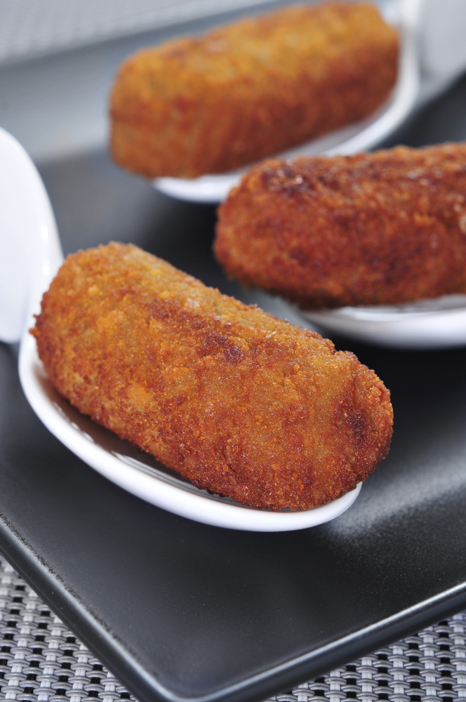
Croquettes

Croquettes are adored by the locals and these are completely different from the potato filled variety served as a simple side dish. The two most popular traditional croquettes have a thick and creamy cheese Belgian dishesor grey shrimp filling. Most menus offer both either as a starter or a main course.

You’ll find croquettes served almost everywhere in this country and the quality comes down to the filling. As a main dish they are usually served with a salad, fried parsley and frites.


Belgian dishes

Sole Meunière

The country’s number one fish dish. The best type of fish for classic dish is what Brits call the Dover Sole. As far as Belgians are concerned, they are just sole. Sharing the Channel is one thing, sharing their most cherished fish another.


Steak Frites

Belgian FoodWhen it comes to national dishes, steak frites is nearly on the same pedestal as moules frites. In specialist grill restaurants you will able to choose between different cuts of prime, domestic and even imported beef.


Let's not forget the illustrious  delicacy  the
Eclair, Belgian sweets

Eclair

Gourmets will rush to the baker’s at lightning speed if there is a fresh batch of éclairs on offer. A coincidence? Not really; as éclair means lightning in the language of Voltaire.


.

May 16-May 20, 2016 We're back in Europe!


The Flag
Welcome to a majestic land covered more than 70% by forest. Known as Suomi in this country's native language it is mostly flat, with more than 50,000 lakes. 

Let's take an adventure to a land filled with deep, green forests, sparkling lakes and snowy landscapes.

It's geographic coordinates are
64º N, 26º E. 


This country gained it's independence from Russia on 6 December 1917 


Currency: Euro

Products: Barley, wheat, sugar beets, potatoes, dairy cattle, fish; metals, electronics, machinery, ships, paper, chemicals


Natural resources: timber, iron ore, copper, lead, zinc, chromite, nickel, gold, silver, limestone

Environment current issues:air pollution from manufacturing and power plants contributing to acid rain; water pollution from industrial wastes, agricultural chemicals; habitat loss threatens wildlife populations. 

Trade is important, with exports accounting for over one-third of GDP in recent years. (GDP or Gross Domestic Product is a broad measurement of a nation’s overall economic activity.)

We found out that this country is historically competitive in manufacturing - principally the wood, metals, engineering, telecommunications, and electronics industries.

It excels in the export of technology for mobile phones as well as promotion of startups in the ICT, gaming, clean tech, and biotechnology sectors.

Except for timber and several minerals, it depends on imports of raw materials, energy, and some components for manufactured goods. 

Because of its climate, agricultural development is limited to maintaining self-sufficiency in basic products. 

Forestry, an important export industry and provides a secondary occupation for the rural population

Food 
Interesting fact is that Reindeer is a major diet staple and is eaten domestically in a variety of ways like reindeer stew, reindeer roast, reindeer pate and reindeer pasta carbonara. Remember we found out that this country is known for it's many lakes. So it stands to reason that fish is another major food and even during the winter. Ice-fishing is a very popular past time. The fish found here are Whitefish, Herring, Salmon and the Artic Char. I wonder how good the sushi is?

Not exported but this country has some of the best chocolate in the world. The market is dominated by "Karl Fazer" which produces 65 million kilos of chocolate per year in a huge variety of flavors and all contain real milk and can be purchased in giant slabs. 

Education
Since this country implemented a huge education reform 40 years ago, the school system has consistently come at the top for the international rankings for education systems. Teachers must hold a Master's Degree and the highly regarded field is compared to that of Doctors and Lawyers. They have four hours of classroom instruction and 2 days of professional development. The children had 75 minutes of recess less with less classroom instruction, no homework and no testing until High School age. 


This country is home to one of the most famous and unique hotel resorts in
all of Europe –
Kakslauttanen igloo village. You can stay in one of their amazing glass igloos over night while watching Northern Lights.


May 9-13, 2016 - Our NEW Destination


We've landed in the country that straddles the equator on South America’s west coast bordering the Pacific Ocean between Colombia and Peru. Its diverse landscape encompasses Amazon jungle, Andean highlands and the wildlife-rich of the Galápagos Islands. 

Compañia de Jesus cathedral


In the Andean foothills at an elevation of 2,850m, Quito, the capital, is known for its largely intact Spanish colonial center, decorated with 16th- and 17th-century palaces and churches including the ornate Compañía de Jesús cathedral. 

Capital: Quito     Largest City: Guayaquil
Currency: United States Dollar

President: Rafael CorreaPop: 15.74 million (2013) World Bank

Official language: Spanish


Administrative divisions: 24 provinces (provincias, singular - provincia); Azuay, Bolivar, Canar, Carchi, Chimborazo, Cotopaxi, El Oro, Esmeraldas, Galapagos, Guayas, Imbabura, Loja, Los Rios, Manabi, Morona-Santiago, Napo, Orellana, Pastaza, Pichincha, Santa Elena, Santo Domingo de los Tsachilas, Sucumbios, Tungurahua, Zamora-Chinchipe

This country is substantially dependent on its petroleum resources, which have accounted for more than half of the country's export earnings and approximately 25% of public sector revenues in recent years.

Agriculture Products: bananas, coffee, cocoa, rice, potatoes, cassava (manioc, tapioca), plantains, sugarcane; cattle, sheep, pigs, beef, pork, dairy products, fish, shrimp and balsa wood

Natural hazards: frequent earthquakes; landslides; floods; periodic drought and itsvolcanic activity is concentrated along the Andes Mountains; Sangay (elev. 5,230 m), which erupted in 2010, is mainland is this country's most active volcano. It's additional historically active volcanoes in the Andes include Antisana, Cayambe, Chacana, Cotopaxi, Guagua Pichincha, Reventador, Sumaco, and Tungurahua. 

Fernandina (elev. 1,476 m), a shield volcano that last erupted in 2009, is the most active of the many Galapagos volcanoes. Additional historically active Galapagos volcanoes include Wolf, Sierra Negra, Cerro Azul, Pinta, Marchena, and Santiago.

Students at a school.
Elementary EducationThis country's constitution says that all children attend school for 9 years and that it is to be free. Although the primary school enrollment rate exceeds 95%, 25% of children will drop out by the end of the 5th grade.
It is believed that in approximately 1,088 primary schools with an average of 1.5 teachers per school are responsible for educating
an average of 63 pupils throughout 6 grades. 

The majority of schools require students to wear a uniform, but there are a few private schools that do not require uniforms. Requiring uniforms can make attending school expensive, especially at private schools. Most schools have two uniforms, one formal the other informal for physical education days.
School Uniforms at one school. 
Girls uniforms usually consist of a skirt, polo or button-down top, white socks and black shoes for the formal uniform. And a tee shirt and sweat pants for physical education. Private schools can be much more complicated with ties, special socks and shoes.
Boys uniforms normally means dress pants and a polo top. And the physical education uniform is very similar to the girls.

A School


Ceviche
The Food
The cuisine is diverse, varying with altitude, and associated agricultural conditions. Pork, chicken, beef, and cuy (guinea pig) are popular in the mountainous regions, and are served with a variety of carbohydrate-rich foods, especially rice, corn, and potatoes.
Ceviche
is claimed as their national dish. Stews of meat, plaintains, and root vegetables are the platos nacionales of several countries in Central America, South America, and the Caribbean: Colombian ajiaco, and the sancocho of the Dominican Republic, Colombia, and Panama.


May 2 - 6, 2016


We are in Southern Asia, bordering the Arabian Sea and the Bay of Bengal, between Burma and Pakistan. This country actually dominates South Asian subcontinent and is near the Indian Ocean trade routes. This country is also home of the third largest mountains in the world (Kanchenjunga) lies on the border with Nepal.


This country has a vast variety of languages spoken. The most important language for national, political and commercial communication is Hindi. 41% of this country's population speaks Hindi. There are 14 other official languages and they are Bengali,Telugu, Marathi, Tamil, Urdu, Gujarati, Malayalam, Kannada, Oriya, Punjabi, Assamese, Kashmiri, Sindhi, and Sandskrit. Hindustani is a combination of Hindi and Urdu and widely spoken throughout this country's northern area but it is not an official language. 
English is this country's sub-official language.
 

Population: 1, 251, 695, 584 (July 2015 est.)


By the 19th century, Great Britain had become the dominant political power on the subcontinent. The British Indian Army played a vital role in both World Wars. Years of nonviolent resistance to British rule, led by Mohandas GANDHI and Jawaharlal NEHRU, eventually resulted in this country's independence, which was granted in 1947.


It's terrain is upland plain (Deccan Plateau) in the south, 
flat to rolling plain along the Ganges, deserts in west, Himalayas in the north.

It's climate varies from tropical monsoon in the south to temperate in the north

This country's administrative divisions are 29 states and 7 union territories*; Andaman and Nicobar Islands*, Andhra Pradesh, Arunachal Pradesh, Assam, Bihar, Chandigarh*, Chhattisgarh, Dadra and Nagar Haveli*, Daman and Diu*, Delhi*, Goa, Gujarat, Haryana, Himachal Pradesh, Jammu and Kashmir, Jharkhand, Karnataka, Kerala, Lakshadweep*, Madhya Pradesh, Maharashtra, Manipur, Meghalaya, Mizoram, Nagaland, Odisha, Puducherry*, Punjab, Rajasthan, Sikkim, Tamil Nadu, Telangana, Tripura, Uttar Pradesh, Uttarakhand, West Bengal

Legal System: common law system based on the English model; separate personal law codes apply to Muslims, Christians, and Hindus; judicial review of legislative acts.

What else can you find out about this county we have landing in week? Give us your clues.

April 25-April 29, 2016


Welcome back from Spring Break 2016. 

We're back on the VES Flying Bus. This week we've traveled to a rugged, landlocked country split by the Great Rift Valley. With archaeological finds dating back more than 3 million years, it’s a place of ancient culture. Among its important sites are Lalibela and its 12th-13th century rock-cut Christian churches, and Aksum, the ruins of an ancient city with obelisks, tombs, castles and Our Lady Mary of Zion church. 

This country is considered the oldest independent country in Africa and one of the oldest in the world (may be traced to the Aksumite Kingdom, merged in the first century B.C.)

Official language: is Amharic
Eastern Africa, west of Somalia

Geographic coordinates: 8 00 N, 38 00 E and is slightly less than twice the size of Texas

Climate: tropical monsoon with wide topographic-induced variation

etymology: the country name derives from the Greek word "Aethiopia," which in classical times referred to lands south of Egypt in the Upper Nile region

Agriculture - products: cereals, coffee, oilseed, cotton, sugarcane, vegetables, khat, cut flowers; hides, cattle, sheep, goats; fish

Imports - commodities: food and live animals, petroleum and petroleum products, chemicals, machinery, motor vehicles, cereals, textiles

Imports - partners: China 19.2%, US 11.4%, Saudi Arabia 6.7%, India 5% (2014)

Enjoy more information from our 5th graders!


APRIL 11TH OUR NEW COUNTRY


 Whew, one more country
before school vacation! 
Kevin shares this country's population.
This week we've landed in a mountainous Central European country, home to numerous lakes, villages and the high peaks of the Alps.

The country is also a destination for its ski resorts and hiking trails. Banking and finance are key industries, and is famous for watches and chocolates 

Do you recognize
the flag?

This county has several official languages Grace shares
one with us but others are German, Italian, and Romansh.

Exports: machinery, chemicals, metals, watches, agricultural products


Imports: machinery, chemicals, vehicles, metals; agricultural products, textiles


To call this Country you need the Country Code.


The Climate and more...

Brooke shares the terrain.
This country is completely landlocked, meaning it is surrounded by land and has no coastlines.

This country is east of France and north of Italy. Geographic coordinates: 47 00 N, 8 00 E
Bordering countries (5): Austria 158 km, France 525 km, Italy 698 km, Liechtenstein 41 km, Germany 348 km 

Climate is temperate, but varies with altitude. It can be cold, cloudy, rainy/snowy winters; cool to warm, cloudy, humid summers with occasional showers

Many of the Old Towns within its cities contain medieval landmarks like capital Bern’s Zytglogge clock tower and Cathedral of Bern. 


Food
There are many regional dishes. One example is Zürcher Geschnetzeltes, thin strips of veal with mushrooms in a cream sauce served with rösti. Italian cuisine is popular, particularly pasta and pizza. Foods often associated with this country include cheese and chocolate. 

Breakfast typically includes bread, butter or margarine, marmalade or honey, maybe some cheese or cereals, plus milk, cold or hot chocolate, tea or coffee.
Lunch may be as simple as a sandwich or a birchermüesli or it could be a complete meal.
Depending on what people had for lunch, dinner can be a full main course or just some bread, cheese, maybe some dried meat or any other light meal.

Drinks range from plain water, over different types of soft drinks including most internationally well known brands. Hot drinks include many different flavors of tea and coffee.

There is a great deal of bread eating in this country! The local people do not only love good food, they also appreciate a beautiful decorated table during the holidays like Christmas.

The Country for April 4th


We've landed on another primarily French speaking country this week. This new country is slightly smaller than the state of West Virginia.  If we were to stand in the middle of this country and look North we would see the country of Burkina Faso, to our East we would see Benin, to our South is the Gulf of Guinea and our VES student, Brooke shares what country is to the West.  


We have learned that the country has 56 km of coastline, and that it is divided into five administrative regions—Maritime, Plateaux, Centrale, Kara, and Savanes—each supervised by an inspector. Can you find more information on these regions? 

What is 56 km converted to miles? 
The USA use the Empirical and/or America Standard form of weights and measures, and the country we are visiting uses the Metric system. 

Sam shares the continent that we're on. 


The largest wildlife has been exterminated in the southern area but in the north area of this country we may find elephants and lions. There are 196 species of mammals, 117 species of birds, and over 3,000 species of plants throughout the entire country. Common animals are Hippopotamus, Crocodiles, Snakes and Monkeys.

The main exports are coffee, cotton, gold, cement and cocoa. Do they import anything?

Their Monetary Unit:  The Communauté Financière Africaine franc (CFA Franc) is a paper currency of 100 centimes.


There are coins of 1, 2, 5, 10, 25, 50, 100,
and 500 CFA francs and notes of 50, 100, 500, 1,000, 5,000, and 10,000 CFA francs. 


($100 CFA Franc equals $17 US Dollars)
The national sports teams are National Football Team, National Rugby Union Team, Davis Cup Team


Peter gives us the longitude and latitude.