Can you name the Country with the Clues we provide? Each day a video clue will be posted right here, and your guesses can be placed in the box by the large map on the way to the gym at Village School. Click on the photo and see the video for a brand new clue. Be sure to check back Monday through Thursday. The Mystery Country will be revealed on Fridays during morning announcements! Have fun learning about other countries and where they are on our map!

3/28/16 We are leaving Europe for the Middle East!


We're flying out of Europe on our way to the Middle Eastern country found on the Mediterranean Sea. This country is regarded by Jews, Christians and Muslims as the Holy Land, and its most sacred sites can be found in Jerusalem. Within its Old City, the Temple Mount complex includes the Dome of the Rock shrine, the historic Western Wall, Al-Aqsa Mosque and Church of the Holy Sepulchre.Its financial hub, Tel Aviv, is known for Bauhaus architecture, beaches and nightlife. 


This country is known today to have a rich and distinctive cuisine reflecting the diversity of it's society, but with roots deeply planted in Jewish and regional customs. Since this country was reborn in 1948, new culinary traditions have emerged. A good example of this is the customary Independence Day picnicin the countryside, typically complete with shishlikkebob -- or American-style steak. These main courses are often accompanied by tehina and hummus, Middle Eastern favorites. 


Another widespread trend is their large breakfast, composed of cheeses, salads, olives, distinctive breads, juice and coffee

Lunch is the principal meal of the day, served at noontime when children return home from school. Most eat lightly in the evening, with dinner possibly consisting of dairy products, salads or eggs. Like in Europe, however, bread is often a part of every meal of the day; this, perhaps, might interest "low-carb" dieters, especially the young, are among the most fit in the Western world!


Video Clue#2

Video Clue #3
Geographic coordinates: 31 30 N, 34 45 E
ContinentAsia
Location: Middle East, bordering the Mediterranean Sea, between Egypt and Lebanon
Geography - note: Lake Tiberias (Sea of Galilee) is an important freshwater source; the Dead Sea is the second saltiest body of water in the world (after Lake Assal in Djibouti); in 2014, there were 423 settlements in this country's occupied territories - 42 settlements in the Golan Heights, 381 sites in the occupied Palestinian territories to include 212 settlements and 134 outposts in the West Bank, and 35 settlements in East Jerusalem; there are no Israeli settlements in the Gaza Strip because all were evacuated in 2005 (2014 est.)


Video Clue #4
Government type: parliamentary democracy
Prime minister: Benjamin NetanyahuPresident: Reuven Rivlin

Agriculture - products: citrus, vegetables, cotton; beef, poultry, dairy products

Industries: high-technology products (including aviation, communications, computer-aided design and manufactures, medical electronics, fiber optics), wood and paper products, potash and phosphates, food, beverages, and tobacco, caustic soda, cement, construction, metal products, chemical products, plastics, cut diamonds, textiles, footwear

Imports - commodities: raw materials, military equipment, investment goods, rough diamonds, fuels, grain, consumer goods
Exports - commodities: machinery and equipment, software, cut diamonds, agricultural products, chemicals, textiles and apparel
Exports - partners: US 26.9%, Hong Kong 8.9%, UK 5.8%, Belgium 4.8%, China 4%, Turkey 4% (2014)
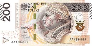
Exchange rates: new Israeli shekels (ILS) per US dollar 3.886 (2015 est.)


Our New Destination for March 21, 2016 - March 24th


We've traveled to Europe. The country we've landed in today has survived centuries of conflict to emerge as a proud, independent country, ready to assume her new role in modern history. We are discovering that this country is rich in fine culture, scenic landscapes and extraordinary historical sites. 

We have so many choices of exploration from the nation’s vibrant cities, Gothic castles, moving sand dunes, and t
he lakes and forests of her picturesque countryside. Dating back to the 13th century, the Main Market Square in the Old Town in Kraków is the largest medieval town square in Europe and one of the main tourist attractions of this country. Its square is surrounded by historical townhouses, historic buildings, palaces and churches. The center of the square is dominated by the Cloth Hall that was rebuilt in 1555 in the Renaissance style and topped by a beautiful attic.


Geography: Central Europe, east of Germany (52 00 N, 20 00 E) and is about twice the size of Georgia but slightly smaller than New Mexico

This European Country regained its independence in 1918 only to be overrun by Germany and the Soviet Union in World War II. It became a Soviet satellite state following the war, but its government was comparatively tolerant and progressive.


Current population: 38,562,189 (July 2015 est.)

The climate is temperate with cold, cloudy, moderately severe winters with frequent precipitation; mild summers with frequent showers and thundershowers.

Natural Resources: coal, sulfur, copper, natural gas, silver, lead, salt, amber, arable land

Agriculture Produce: potatoes, fruits, vegetables, wheat; poultry, eggs, pork, dairy

Industry: machine building, iron and steel, coal mining, chemicals, shipbuilding, food processing, glass, beverages, textiles

Currency Exchange rates:
200 Polish Zloty equals 52.68 US Dollars


Commodities Trades
Exports: machinery and transport equipment 37.8%, intermediate manufactured goods 23.7%, miscellaneous manufactured goods 17.1%, food and live animals 7.6% (2012 est.)

Imports: machinery and transport equipment 38%, intermediate manufactured goods 21%, chemicals 15%, minerals, fuels, lubricants, and related materials 9% (2011 est.) 

Import Partners: Germany 28%, Russia 9.1%, China 6.5%, Netherlands 5.9%, Italy 5.5%, France 4.2%, Czech Republic 4.2% (2014)

Environmental Issues: decreased emphasis on heavy industry and increased environmental concern by post-communist governments has improved environment; air pollution remains serious because of emissions from coal-fired power plants and the resulting acid rain has caused forest damage; water pollution from industrial and municipal sources is also a problem, as is disposal of hazardous wastes

Video Clue #1
Video Clue #2
Video Clue #3

Video Clue  #4


Visiting a Country with Atlantic Beaches and Portuguese Cuisine

This week we're visiting a nation whose varied terrain is full of tropical Atlantic beaches, a labyrinthine system of rivers and Sub-Saharan desert that extends across its borders. The country's colonial history is reflected in its Portuguese-influenced cuisine and its landmarks including Fortaleza de São Miguel, built by the Portuguese in 1576 to defend the country's capital.

This country is more than three times the size of California.

The original inhabitants are thought to have been Khoisan speakers. After 1000, large numbers of Bantu speakers migrated to the region and became the dominant group. The country's name is derived from the Bantu kingdom of Ndongo, whose name for its king is ngola.

Explored by the Portuguese navigator Diego Cão in 1482, this country became a link in trade with India and Southeast Asia. Later it was a major source of slaves for Portugal's New World colony of Brazil. Development of the interior began after the Berlin Conference in 1885 fixed the colony's borders, and British and Portuguese investment fostered mining, railways, and agriculture.

One of Africa's major oil producers, is striving to tackle the physical, social and political legacy of a 27-year civil war that ravaged the country after independence.
Following the withdrawal of the Portuguese colonial masters in 1975, the rival former independence movements competed for power until 2002.
Much of this country's oil wealth lies in Cabinda province, where a decades-long separatist conflict simmers.
The government has sent thousands of troops to subdue the rebellion in the enclave, which has no border with the rest of it's country. Human rights groups have alleged abuses against civilians.
Geographic Location: 12 30 S, 18 30 E

Monetary unit: (Country) Kwanza

Video Clue #1
Agriculture: bananas, sugarcane, coffee, sisal, corn, cotton, manioc (tapioca), tobacco, vegetables, plantains; livestock; forest products; fish.

Labor force:
9.018 million; agriculture 85%, industry and services 15% (2003 est.).

Industries: petroleum; diamonds, iron ore, phosphates, feldspar, bauxite, uranium, and gold; cement; basic metal products; fish processing; food processing, brewing, tobacco products, sugar; textiles; ship repair.

Natural resources:
petroleum, diamonds, iron ore, phosphates, copper, feldspar, gold, bauxite, uranium.

Exports:
$70.84 billion (2013 est.): crude oil, diamonds, refined petroleum products, gas, coffee, sisal, fish and fish products, timber, cotton.

Imports:
$26.09 billion (2013 est.): machinery and electrical equipment, vehicles and spare parts; medicines, food, textiles, military goods.

Major trading partners:
U.S., China, India, South Africa, Portugal, Brazil (2012)


Video Clue #2
Video Clue #3
Video Clue #5
Video Clue #4


New Country for the Week of March 7th


Hello Village, our VES Flying Bus has us in our new country on the Southeast Asia’s Indochina peninsula known for tropical beaches, royal palaces, ancient ruins and ornate temples displaying figures of Buddha, a revered symbol. 

Geographic coordinates: 13 45 N, 100 31 E


The capital, an ultramodern cityscape rises next to quiet canal and riverside communities. Commercial hubs such as Chinatown consist of labyrinthine alleys crammed with shophouses, markets and diners. This country is about three times the size of Florida and slightly more than twice the size of Wyoming. 

The climate is very rainy, warm. It can be cloudy often during the southwest monsoon season from mid-May to September and then very dry and cool during the northeast monsoon beginning in November through mid-March. The southern isthmus is always hot and humid. 

The natural resources are tin, rubber, natural gas, tungsten, tantalum, timber, lead, fish, gypsum, lignite, fluorite, and arable land. 

Natural hazards: land subsidence in Bangkok area resulting from the depletion of the water table; and droughts.

Environment - current issues: air pollution from vehicle emissions; water pollution from organic and factory wastes; deforestation; soil erosion; wildlife populations threatened by illegal hunting.

Agriculture: rice, cassava (manioc, tapioca), rubber, corn, sugarcane, coconuts, palm oil, pineapple, livestock, fish products

Industries: tourism, textiles and garments, agricultural processing, beverages, tobacco, cement, light manufacturing such as jewelry and electric appliances, computers and parts, integrated circuits, furniture, plastics, automobiles and automotive parts, agricultural machinery, air conditioning and refrigeration, ceramics, aluminum, chemical, environmental management, glass, granite and marble, leather, machinery and metal work, petrochemical, petroleum refining, pharmaceuticals, printing, pulp and paper, rubber, sugar, rice, fishing, casava, world's second-largest tungsten producer and third-largest tin producer


CLUE #1


CLUE #2

 Clue 2

CLUE #3


CLUE #4


NEW COUNTRY - February 29, 2016


We've landed in the tropics! Can you find where we are? 


The geographic coordinates are 18 32 N, 72 20 W
This country gained their independence from France on 1 January 1804

This Country's free market economy enjoys the advantages of low labor costs and tariff-free access to the USA for many of its exports. Two-fifths of the population depends on the agricultural, mainly small-scale subsistence farming, and remains vulnerable to damage from frequent natural disasters, on top of the country's widespread deforestation. 

Poverty, corruption, vulnerability to natural disasters, and low levels of education for much of the population are among its most serious impediments to economic growth. Its primary imports are food, manufactured goods, machinery, and transport equipment fuels and raw materials. 

Exchange rates: gourdes per US dollar - $47.63 (2015 est.)

Student Clue #1


Student Clue #2 


Student Clue #3 


Student Clue #4